Achieving optimal soil turnover and maximizing yield potential begins with leveraging advanced tools designed to transform traditional plowing into a finely tuned operation. Integrating GPS guidance into your plowing routine can deliver unparalleled precision and efficiency, reducing waste, improving fuel usage, and enhancing overall field accuracy. This article explores key strategies and practical recommendations to help farmers harness the full power of GPS-assisted plowing.
Understanding GPS Guidance Systems
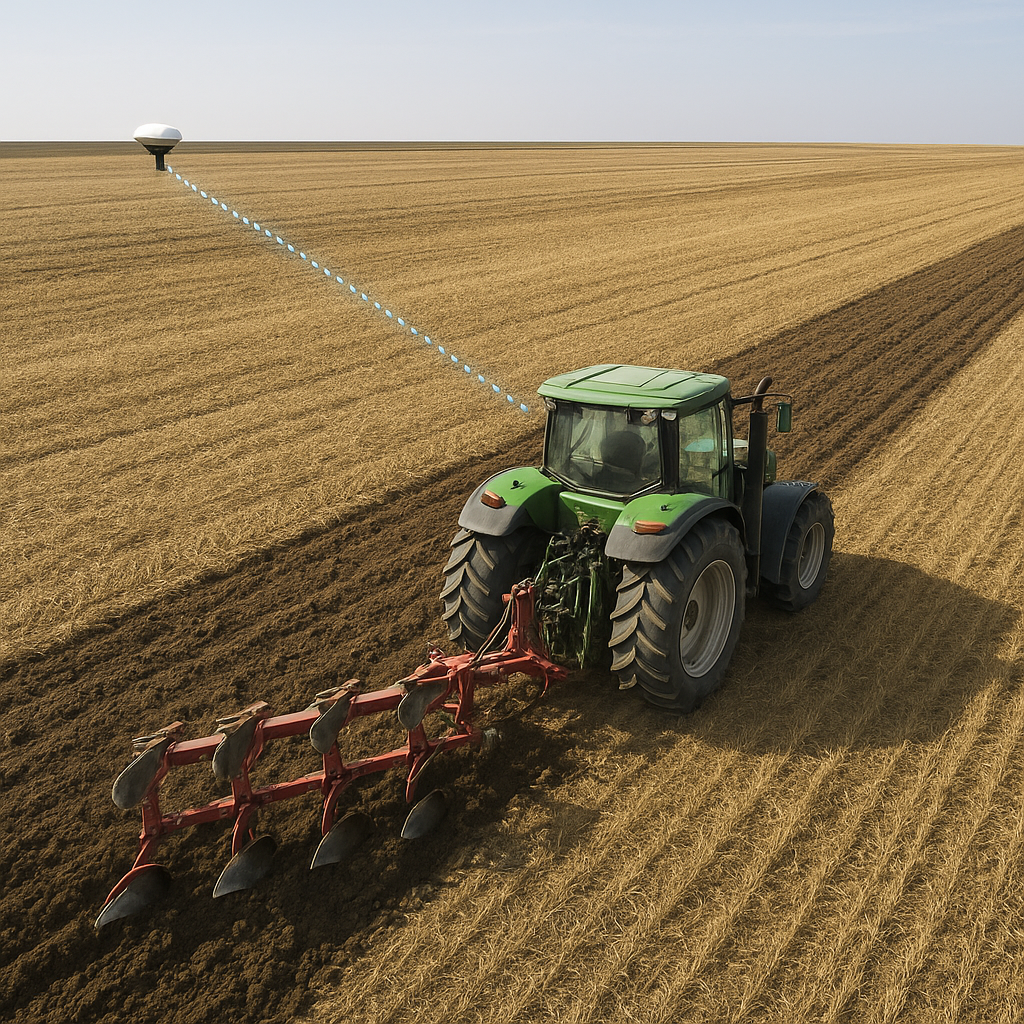
Before diving into field tactics, it’s essential to grasp the fundamentals of GPS technology in agricultural contexts. Modern GPS guidance systems combine satellite signals, onboard computers, and field mapping software to provide real-time positioning information. The result is a guidance platform that helps you maintain straight lines, consistent coverage, and minimal overlap.
Components of a GPS Guidance System
- Receiver: Mounted on the tractor roof, it collects satellite data to determine the machine’s exact location.
- Display Unit: Shows field maps, tramline patterns, and guidance lines for the operator.
- Steering Control: Interfaces with hydraulic or electric steering systems to automatically correct the tractor’s path.
- Mapping Software: Records applied passes and generates prescription maps for variable-rate operations.
Key Benefits of GPS in Plowing
- Reduced overlap and missed zones.
- Uniform furrow depth due to consistent travel paths.
- Enhanced field productivity by minimizing wasted time navigating.
- Documentation of operations for compliance and analysis.
Optimizing Field Layout and Plow Settings
Successful GPS-assisted plowing starts with proper field preparation and plow calibration. Attention to details such as field boundaries, obstacle mapping, and equipment setup will pay dividends throughout the season.
Field Boundary and Obstacle Mapping
- Walk or drive the perimeter to record consistency in boundary lines on your display.
- Note permanent obstacles—trees, poles, drainage ditches—so automated guidance can adjust paths safely.
- Create interior tramlines for turning zones and headlands to optimize turning radius and maneuvering.
Adjusting Plow Configuration
- Set appropriate furrow width to match your tractor’s pulling capacity and implement rating.
- Balance plow beam height so each share engages the soil consistently.
- Use front and rear weights to maintain stability and reduce draft variation.
- Calibrate spring or hydraulic depth controls to correct for field hardness changes.
Tuning GPS Settings for Optimal Performance
- Select the correct guidance pattern: straight lines, contours, or manual tramlining.
- Set signal correction to RTK or WAAS depending on the accuracy required.
- Adjust display brightness and alert volume so you never miss a steering prompt.
- Regularly update firmware and maps to maintain cutting-edge technology integration.
Practical Tips for GPS-Assisted Plowing
With your system and equipment prepped, focus on in-field best practices that amplify the benefits of GPS guidance. Consistent habits and strategic decisions will push your performance to the next level.
Starting a Job
- Position the tractor at a corner of the field, ensuring the receiver has clear sky visibility.
- Engage the GPS guidance before lowering the plow—this prevents erratic paths while searching for satellites.
- Follow the first pass slowly to verify alignment; minor adjustments now avoid major corrections later.
Maintaining Straight Passes
- Trust the system’s steering prompts rather than constantly making manual tweaks.
- Keep a steady ground speed to allow the autopilot to adjust heading smoothly.
- Watch for wheel slip; excessive slip can degrade guidance accuracy.
Handling Field Variability
- Be prepared to switch to a secondary pass mode if terrain becomes too steep for straight guidance.
- When encountering rocky or uneven patches, reduce speed to maintain a constant depth.
- Use sectional control on larger plow wings to float or lift sections over obstacles automatically.
Advanced Strategies for Maximum Yield
For those seeking to push yield and resource savings even further, consider integrating GPS plowing data with other precision farming tools.
Variable-Rate Tillage Integration
- Generate soil compaction and moisture maps using yield monitors and sensors.
- Adjust plow depth dynamically in areas that require softer or firmer seedbeds.
- Optimize fuel consumption by matching draft load to field conditions in real time.
Data Analysis and Record Keeping
- Export pass coverage maps to evaluate coverage uniformity and identify missed zones.
- Track field hours and fuel burn to calculate cost per acre and refine your operations budget.
- Maintain digital logs for compliance reporting and long-term trend analysis.
Integrating with Autonomous Tractors
- Sync GPS data protocols for seamless handover between manned and unmanned operations.
- Use advanced collision avoidance systems tied into your guidance network.
- Plan multi-day shifts with battery or fuel logistics for fully autonomous plowing.
Maintenance and Troubleshooting
Reliable performance hinges on regular upkeep of your GPS hardware and plow equipment. Simple checks can prevent downtime during peak field windows.
- Inspect antenna mounts and cables for corrosion or physical damage.
- Clean plow shares and moldboards after each use to avoid rust and wear.
- Calibrate system offsets annually or after any component replacement.
- Test the guidance system in an open area to confirm satellite lock and steering response.
Conclusion
By carefully aligning your field layout, fine-tuning plow settings, and adopting GPS guidance best practices, you can achieve a new level of operational performance. Embrace these strategies to reduce costs, boost soil health, and propel your farm toward sustainable productivity gains.