Integrating GPS-assisted technology into plowing operations can transform traditional farming methods by enhancing precision and boosting overall productivity. To fully leverage these advantages, operators must receive comprehensive instruction on both technical and practical aspects. This article outlines step-by-step strategies for training personnel, from selecting the right systems to applying advanced troubleshooting techniques.
Selecting the Right GPS Equipment and Software
Before any hands-on training begins, agribusiness managers should guide operators through the process of choosing appropriate hardware and software. Understanding the features of different systems lays the foundation for efficient plowing and long-term success.
Evaluating Receiver Quality and Signal Types
- Investigate receiver classes: differentiating between GLONASS, GPS, RTK, and SBAS solutions
- Consider signal correction sources: base stations, mobile networks, or satellite-based augmentation systems
- Assess durability ratings for field conditions: water resistance, shockproof design, and temperature tolerance
Choosing Compatible Software Platforms
- Review user interfaces for ease of navigation and real-time guidance
- Ensure compatibility with existing tractors and implements via ISOBUS or proprietary connectors
- Check update policies: frequency of software releases, technical support availability, and data security
Assessing Additional Tools and Accessories
- Display mounts: easy access for operators without disrupting visibility
- Mapping modules: for importing field boundaries, soil maps, and yield data
- Wireless data transfer devices: for seamless upload and download of field plans
Structuring a Comprehensive Training Program
Developing a curriculum tailored to operator backgrounds ensures that everyone—from novices to experienced drivers—achieves consistent accuracy and efficiency in the field.
Classroom Theory and Safety Briefings
- Fundamentals of satellite positioning: understanding latitude, longitude, and elevation
- Importance of safety protocols when installing or adjusting GNSS antennas
- Data privacy and field boundary security: protecting sensitive farm information
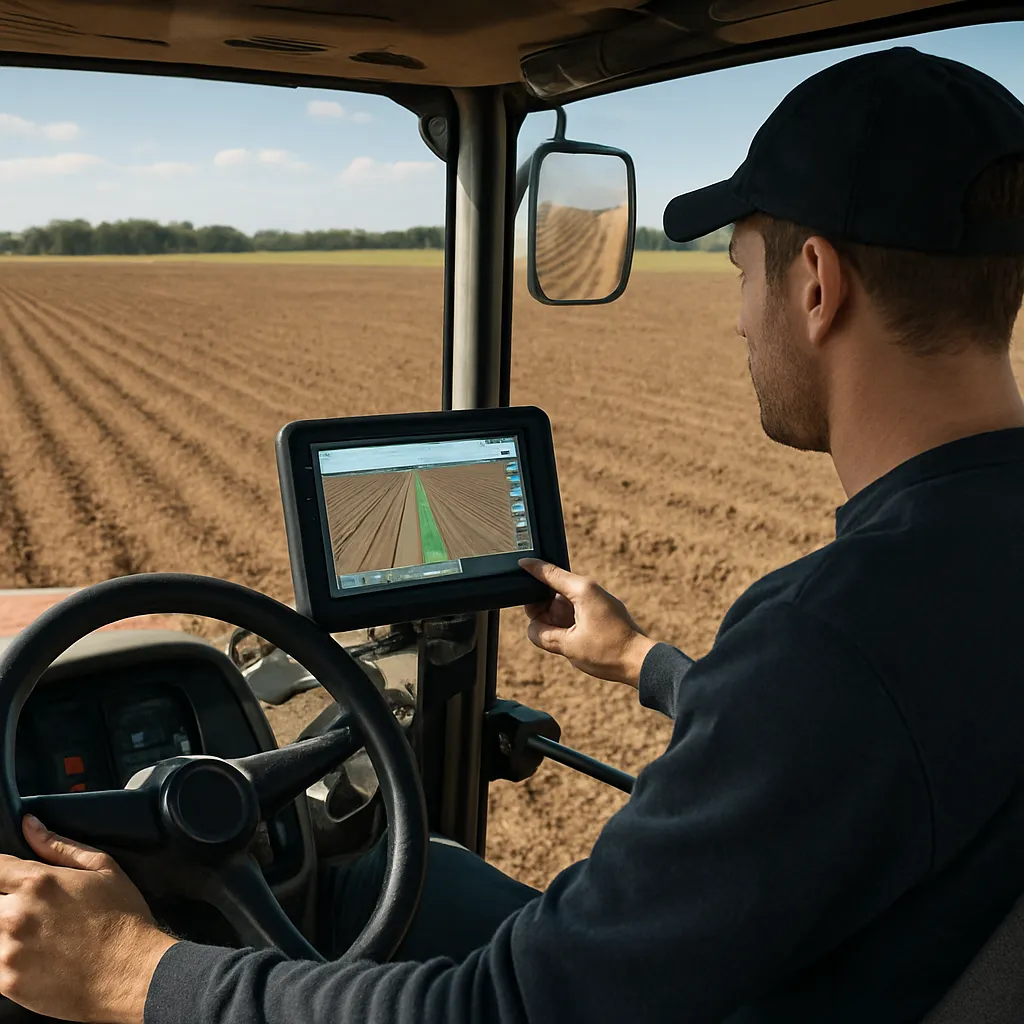
Hands-On Equipment Assembly
- Mounting the GNSS receiver securely on the tractor roof or cab frame
- Connecting the display unit and performing initial hardware checks
- Calibrating depth and lift sensors for plow implements to achieve uniform furrow depth
Practical demonstrations should allow each trainee to complete assembly steps under the guidance of an experienced instructor. Emphasize the role of calibration in achieving consistent results across different field conditions.
Simulated Field Exercises
- Practice driving straight lines without guidance, then switch on the system to observe differences
- Test varying speeds and turn radii to see how guidance lines adjust in real time
- Simulate boundary maneuvers and edge adjustments to build operator confidence
Mastering Field Operations and Best Practices
Once operators are comfortable with core functions, focus on refining navigation skills and leveraging advanced features.
Implementing Section Control and Auto-Steering
- Activate automatic section control to minimize overlap and reduce waste
- Tune auto-steering responsiveness to suit individual driving styles and soil conditions
- Monitor steering corrections through the display and adjust gain settings for accuracy
Utilizing Variable Rate and Prescription Mapping
- Import variable-rate plowing maps to optimize soil disturbance based on soil type
- Train operators to interpret color-coded prescriptions and adjust plow settings on the fly
- Review performance data post-field to make informed agronomic decisions
Maintaining Consistent Field Patterns
- Employ headland turns and end-of-field procedures to preserve straight lines
- Utilize “return to headland” features for precise re-entry points
- Encourage operators to record unintended skips or overlaps for correction in future seasons
Advanced Troubleshooting and Ongoing Support
Even with thorough training, challenges can arise. Equipping operators with troubleshooting know-how ensures minimal downtime and sustained productivity.
Common Signal and Connectivity Issues
- Diagnose signal dropouts: verify antenna placement and remove obstructions
- Resolve RTK base station link failures by checking data radio settings and signal strength
- Switch to fallback correction sources when primary service is unavailable
Diagnosing Hardware and Software Faults
- Interpret error codes on the display: use manufacturer manuals for quick reference
- Update firmware to address known bugs and performance enhancements
- Perform hardware resets carefully, respecting system initialization protocols
Building a Culture of Continuous Improvement
- Encourage regular feedback sessions where operators share field experiences
- Maintain a logbook for unusual events, environmental variables, and system anomalies
- Organize refresher workshops at least annually to review new features and techniques
Maintenance, Data Management, and Performance Monitoring
Proper upkeep of both machinery and digital assets is crucial for sustained success in GPS-assisted plowing.
Routine Equipment Inspections
- Inspect antenna mounts and cabling for wear or damage before each season
- Clean connectors and apply dielectric grease to prevent corrosion
- Lubricate moving components of the plow and test hydraulic lines under pressure
Managing Digital Field Records
- Back up prescription files, boundary maps, and guidance logs to cloud services or local servers
- Organize data in a consistent folder structure for easy retrieval
- Ensure encryption and access controls for sensitive farm planning documents
Analyzing Performance Metrics
- Track overlap percentage and missed areas to quantify time and input savings
- Monitor fuel consumption patterns to evaluate cost-effectiveness of guidance features
- Compare season-over-season data to confirm improvements in field uniformity